The ideal inspection drone for facilities. From roof inspection drones to massive large scale facilities and long line infrastructures drone inspection, companies are turning to inspection drones as force multipliers to complete their projects in time
ELEVATE INSPECTION & DETECTION WITH INSPECTION DRONES
The post pandemic era is characterized in many countries by an increased investment in infrastructure projects. They are launching these to kick start flagging economies and create jobs. This incluces the American Infrastructure Plan (below). But with this increase rate of demand traditional methods of facilities inspection, planning and monitoring will not be enough anymore.
The American Infrastructure Plan
“The American Jobs Plan is an investment in America that will create millions of good jobs, rebuild our country’s infrastructure, and position the United States to out-compete China. Public domestic investment as a share of the economy has fallen by more than 40 percent since the 1960s”.
The White House
The Biden Administration has tabled an ambitious infrastructure proposal to upgrade America’s ageing infrastructure. ($1 Trillion Infrastructure Bill Heads for Senate Debate)
The need for timeous maintenance of infrastructure is further illustrated by the recent Mexico rail bridge collapse where 26 people died.

The scope infrastructure upgrade plan is massive and includes:
- 160,000+ bridges, inspection for each one happens every two years
- 140,000 miles of rail,
- 4 million miles of road,
- 835,000 kilometres of pipeline (read about pipeline inspection),
- 550,000 cell towers,
- 6,500 large active mines,
- 90,000 oil and gas wells,
- 60,000 substations,
- 200,000 miles of high-voltage power lines
- 5.5 million miles of residential power line.
Will these project be completed on time?
A programme this size runs the risk of becoming a never ending series of upgrade cycles. This runs the risk of not achieving the set objectives of a tangible step function increase in American competitiveness. It is important to achieve this in a finite and foreseeable time horizon. In addition, it is also important to spend money wisely meet project objectives.
Other notable infrastructure projects include:
Kano – Kaduna railway in Nigeria
A railway line of 1343km which will link the Lagos – Ibadan railway project and the Kano – Maradi project.
100km section of Western Railway Line in Ghana
A US$ 708M project to construct a 100km section (from Takoradi port to Huni Valley) of the Western Railway line.
High-speed rail project between Dallas and Houston
A US$16 billion project for a 200 mph train system that would get passengers from Dallas to Houston in 90 minutes. The rail line will span 236 miles and create the following jobs:
Jobs
- 17,000 direct jobs.
- 20,000 supply chain jobs
- 1,400 permanent jobs
- an estimated US$36 billion economic impact over the next 25 years.
55 steel bridges in Cameroon
The Ministry of Public Works intends to revive a project for the construction of 55 steel bridges in Cameroon.
Key Constraints and Force Multipliers
The well documented in the economic phenomena (Solow Model) shows that technological progress alters the relationship between inputs and the output of goods and services. This enables increases in Labour’s capacity to produce.
from work by the Nobel Economics Prize winner: Robert Solow
In practical terms for construction projects ‘technological progress‘ means the following:
Constraint 1: Traditional Methods. Infrastructure planning, assessment and monitoring will never be achieved with traditional procedures and workflows such old snooper trucks and rope-inspection teams.

Force multiplier 1: In order to multiply efforts and reduce costs, we need to work smarter rather than harder by leveraging technology —that is, we need to get more output with less input per UAV (drone). The only way to overcome above challenges is adopt modern technology like drones.
Constraint 2: Drone pilots. The next constraint is – there simply are not enough drone pilots, and not enough time to train them. Drone pilot operated missions are inherently constrained by the fact that operator also has to concentrate on piloting.

Force multiplier 2: Automation flights with a one-to-many relationship between operator and UAVs (drones) allows for significantly more output per human drone operator who could be operating a number of drones from a command centre.
Drone inspection with AI
Drones become roaming extensions of IOT systems. The UAV platform interacts with various sources of sensor data. Which it then analyses for patterns and then uploads into cloud platforms where AI is applied.
Drone inspection cost
Drones will bring inspection costs right down. Planners can send drones into hard to reach areas, including rough and dangerous terrain. After capturing aerial data is captured in the form of high resolution images and laser scanning data, these are then georeferenced to specific points on the Earth’s surface.
The aerial view added to the appropriate sensors, drones are able to collect real-time environmental data such as gas detection, perform surveying duties, and track real-time construction progress. The drone solution expands traditional planning methods, all while saving money and enhancing human safety.
Roof inspection by drone
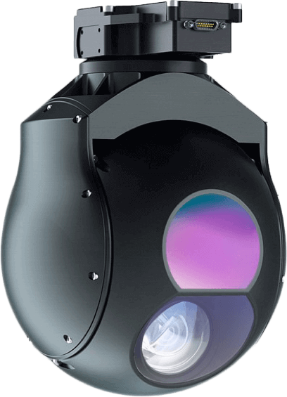
Drone infrastructure inspection has also extended to domestically to homes using thermographic cameras to inspect house roofs,electrical and production installations for the detection of heat related faults or defects.
Drones for inspection: Actionable Intelligence
The data and intelligence that drones can gather that are both useful and actionable. The UAV-based sensors create 3D models for the full construction life cycle. This is also known as Building Information Modelling (BIM). These digital twins are used optimize the workflows of engineers and architects.
Typical Inspection Drone Use Cases
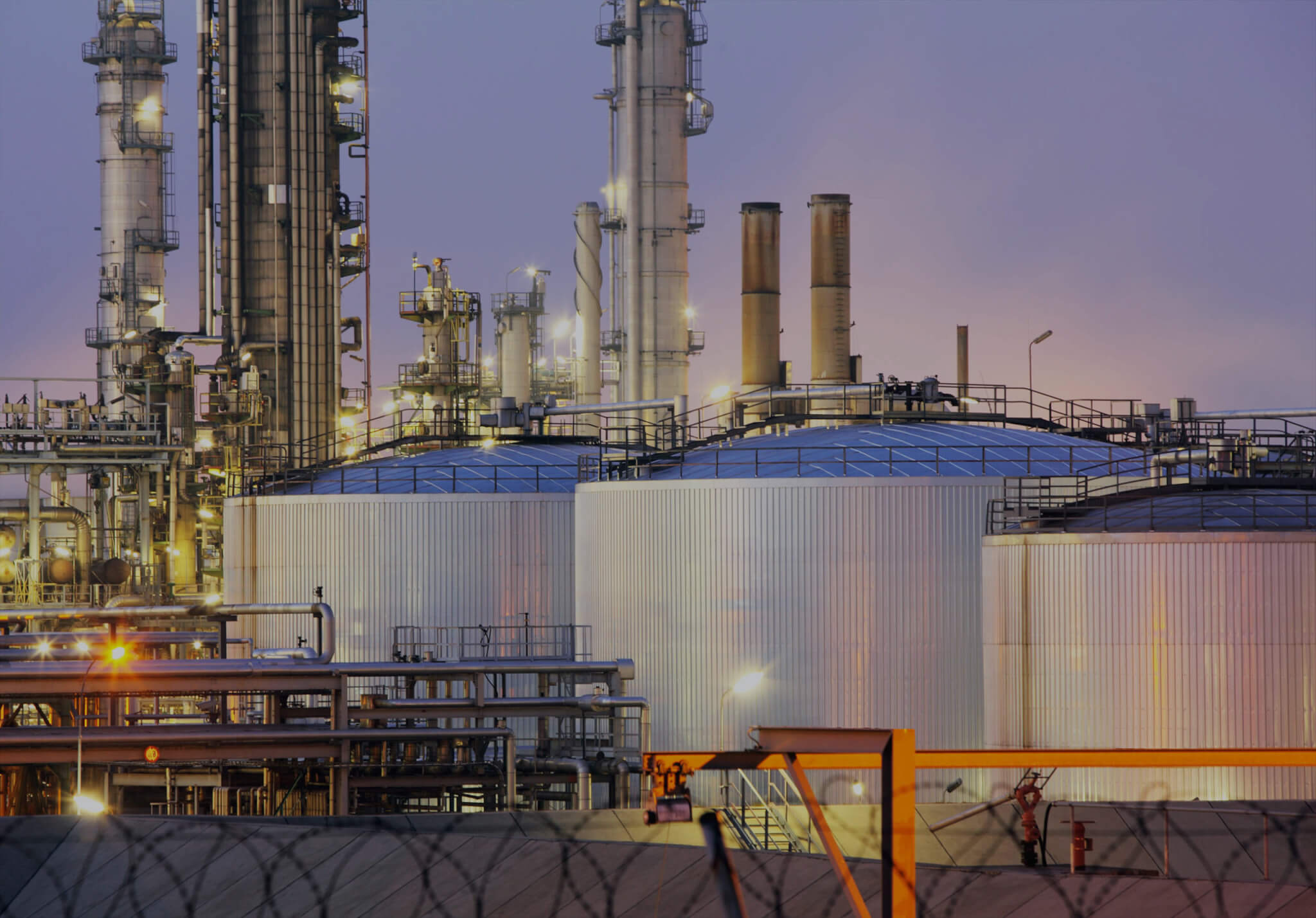
One example of an assignment containing these elements is a flare inspection on an oil-gas platform, where the flare is still active. Here the drones collect picture- or thermographic data of the flare’s condition, while production continues unaffected.

Drones are often used under conditions where there are considerable challenges.
- Inspection of flares,
- Collect picture- or thermographic data of the flare’s condition, while it is in production.
- Inspection of chimney reveals corrosion areas and cracks in the concrete.
It is especially relevant to choose the advanced drones when measuring flue gas emissions, or inspecting wind turbines, where a thermographic camera can detect delaminating, (internal composite layers separating beneath the surface).
The drone inspection itself is normally quickly finished. Most of the work lies in the analysis of the data collected, and the pictures from the drones. It is essential here to enlist relevant experts in analysis to obtain the full value from a drone inspection.
Bridge Inspection.
The latest advances in drone autonomy allows the drone to fly in GPS-denied environments and allows inspectors to look up and inspect the underside of the bridge. In addition drone-based LiDAR data can detect vertical and horizontal displacements of bridge components.
Telecom Mast Inspection.
DAA (Detect and Avoid) technologies help drones to safely navigate up close to cell tower structures, where high performance sensors generate detailed imagery and 3D datasets for viewing in the field or exporting to photogrammetry engines.
Facility Inspection.
With automated computer vision navigation systems that don’t rely on magnetometer calibration, drones can fly confidently near transmission and distribution towers that emit high levels of EMI. Therefor fewer visual observers are sent to remote areas to provide redundancy on complex inspections resulting in added safety.
Construction Site Inspection and Monitoring.
Key to effective construction site management remotely by drone is the ability to autonomously capture complex structures up close from every angle to build digital twins and 3D models of construction sites. This will allow for low altitude flights among obstacles and more frequent and accurate progress tracking.
Limitations of manually operated drones
Drones to naturally extend the range reach of most operations. The ‘human’ (pilot) in the loop is still the major constraint.
Looking straight up (bridge inspection) and flying (hovering) in GPS-denied environments are not possible.
Manually controlling BVLOS missions using only the GCS screen is daunting requiring extreme skill, and hours of painstaking flight required for long range missions beyond the physical limits of most pilots. These unique requirements are definitely not very scalable and the risk of crashes and high pilot training costs expensive.
Designers build drones around a fundamental assumption. That a pilot will focus 100% on keeping their aircraft from crashing. Manual drones are incapable of meeting the demands of enterprise inspection programs looking for precision, cost-effectiveness, and safety.
Automated drone inspections
The Age of Autonomy
On the other hand known infrastructure layout enables predictable flight path planning with autonomous drones which lets the drone operator focus on the task at hand. Rather than the complexity of piloting the drone taking advantage of advances in AI, computer vision, and robotics to fly autonomously through the most demanding environments.
There are different levels of autonomy with the most autonomous requires a drone to be able to see, understand, predict, and act upon the prevailing circumstances. This ability to react intelligently and autonomously is very similar to the OODA model used in ISR operations:
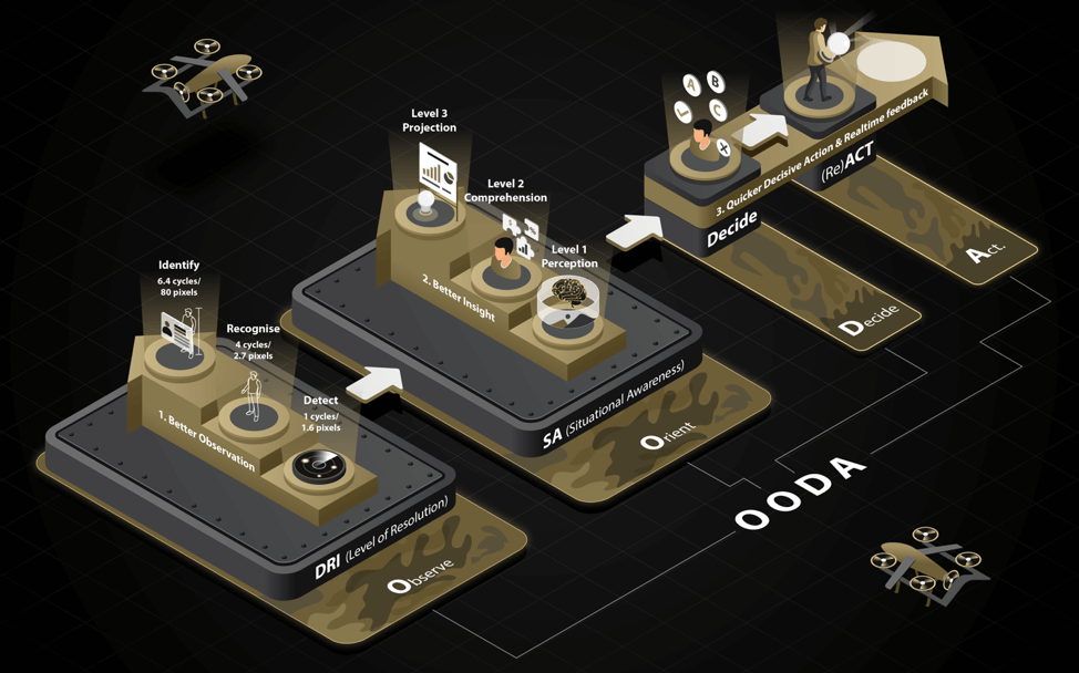
More Precise Data, Shorter Lead-times, Lower Risk
Facilities tend by complex in design by nature and therefor difficult to navigate closely. Pilots sacrifice speed and quality for safety. In addition, increasing the power, and costs (and financial risks), of sensor payloads further compensate for conservative flight paths.
Adopting autonomous drones with 360° obstacle avoidance helps to overcome these conservative flight paths. Additionally, automated flight plans are able to fly up-close and generate higher-quality 3D models providing more precise data, more quickly and cheaper.
Pilot skill level.
Long range/flight time close-up inspection missions are both daunting and demanding on human pilots. It therefor requires a high level of expertise. The inherent safety of highly autonomous flights further reduces the pilot training requirements as well as the need for such scarce resources.
Autonomy allows scalability
Most levels of UAV autonomy enables unshackling of the 1:1 ratio of pilot to drone to a 1:many ratio between operator and drones. This includes less focus on piloting skills and more on operating the sensor payloads and data. The higher levels of precision, cost-effectiveness, and safety ensure the achievement of business outcomes.
Read more..
CONCLUSION
Technology are able to assist in planning, optimizes jobsite progress, reduces costs, and improves safety. As such drones are rapidly becoming indispensable tools for city planners and transportation departments to survey, monitor and inspect infrastructure projects.
An increasing number of companies today are using drone technology for visual inspection. It is a cost-conscious and effective way to inspect at heights and inaccessible areas.
Further advantages
- Quick overview and evaluation of the condition
- Sharp and detailed photographs of defects
- Preventive maintenance planning and optimised production
- Access to hard to reach areas
- Reduced downtime
- High level of safety.
20 km range inspection drone
A popular bench mark for long range drones is the 20km range. Consequently, longer range drones like the ATLAS-V and the ATLAS-T provide significantly enhanced inspection efficiency.

